I cut a globe stress ball (from Aliexpress) into half and inserted a magnet strip so that the 2 halves will stick together. Printed the internal structure and glued them onto the halves as shown below. To protect the printout, I put a layer of transparent tape over it. The model helps the students to visualise the internal structure of the earth and how the plates move due to the convection current in the mantle.
7cm globe template -
I also use a torch light and the globe to show how the rotation of earth leads to day and night, resulting in daily variation in temperatures.
The globe can be used as a talking piece. Anyone who gotten the globe will need to answer or speak up.
Bought world map wall sticker (from Aliexpress) and stuck them on cardboard (recycled from boxes). Then I stick the self adhesive magnet strips (from Daiso) to the pieces so that it can stick to the whiteboard. I can shift the pieces around to show the Pacific Ocean and the Ring of Fire or to show the sea floor spreading in the Atlantic Ocean. To illustrate that the maps they see is 2D and that the American continents can be seen on the left or right of the map.
It can also be used to get the students to know more about the continents.
I did not paste the wall stickers onto cardboard last year. It crumbled but seems that the color is nicer. Maybe I should paste them on white cardboard.
Using the world map with the labels. As mentioned I have stuck the magnetic strips behind them so it's easy to move them around and can use it for various topics. You can also the labels for the different stages in GI which I have pasted magnetic strips behind. I would use them to show the stages and also get students to arrange the stages as well as the components for each.
Used with Kahoot, my students' favourite quiz app. You can read more on my use of kahoot @ https://ezitnew.blogspot.sg/search/?q=kahoot
The students also played this interactive game on plate tectonic - great way to make them learn the names of tectonic plates
http://www.learner.org/interactives/dynamicearth/plate2.html
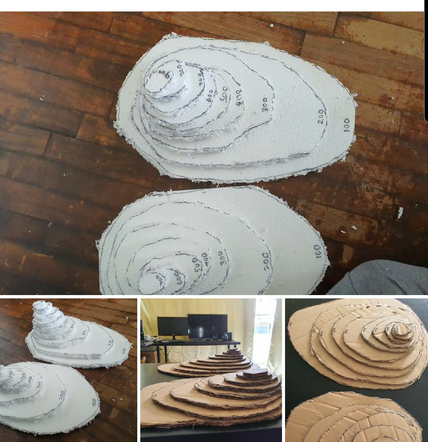
Another model which I made out of recycled cardboard is to show how contour lines can show topography.
Top view which shows the contour lines and contour intervals.
Side view which show a steeper gradient when the contour lines are close to each other and a gentle slope when the contour lines are far apart from each other.
ICT can complement old sch teaching aids.